Find your way, off the grid.
Sahale GPS is made for hikers and anyone who loves the outdoors. Find a trail, plan your day, and download the map so you never lose your way when you lose signal.
The iPhone and Android apps are now being tested and will be on their way to the App Store and Google Play soon.
What it does
Everything for the day, and nothing that needs a signal.
Thousands of trails
More than 105,000 trails and counting, each with its length, gain, difficulty and an elevation chart, to help you find the right one for you.
Maps that work offline
Download a trail or area. The map, the trails and your position keep working when your signal fails.
Record your hikes
Track your distance and gain as you go, with a breadcrumb line on the map showing where you have been, to help you stay on the trail and find your way back. Bring in tracks from other apps, or take yours with you as GPX, KML or GeoJSON.
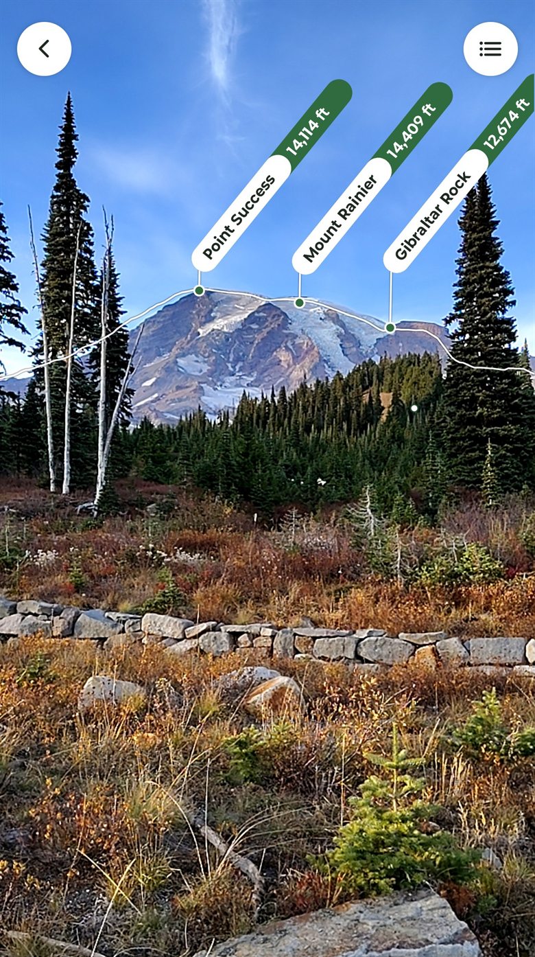
Peak ID
Hold up your phone and the summits on the horizon are named where they stand, with their heights.
Know before you go
Active wildfire areas on the map, park closures and danger alerts on the trail page, and a seven-day forecast for the trailhead.
Campgrounds and a packing list
Thousands of campgrounds with trails nearby, and a Backpack checklist with optional templated items such as the Ten Essentials.
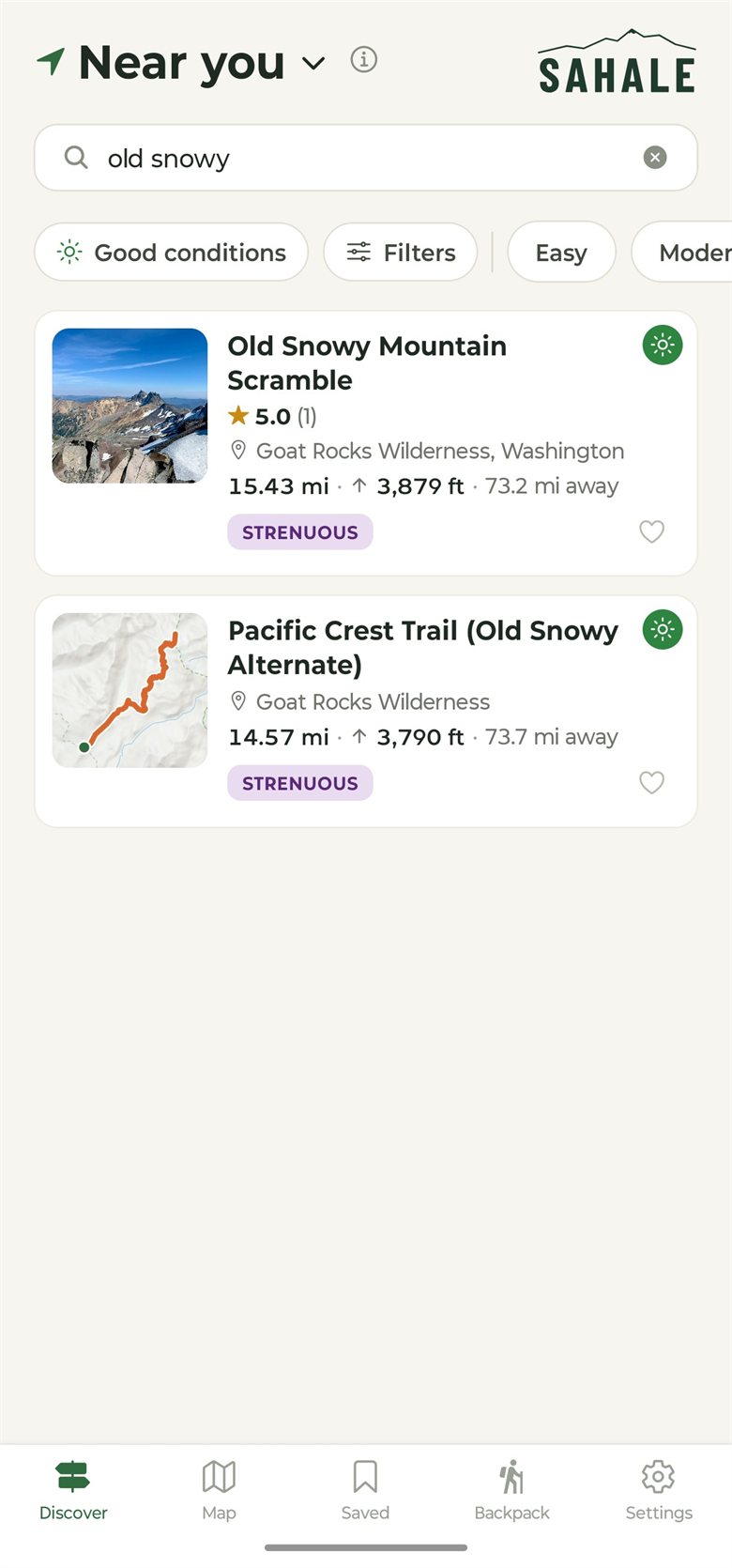
Start with what’s near you
Search by name or place, or filter by length, gain, difficulty and today’s conditions.
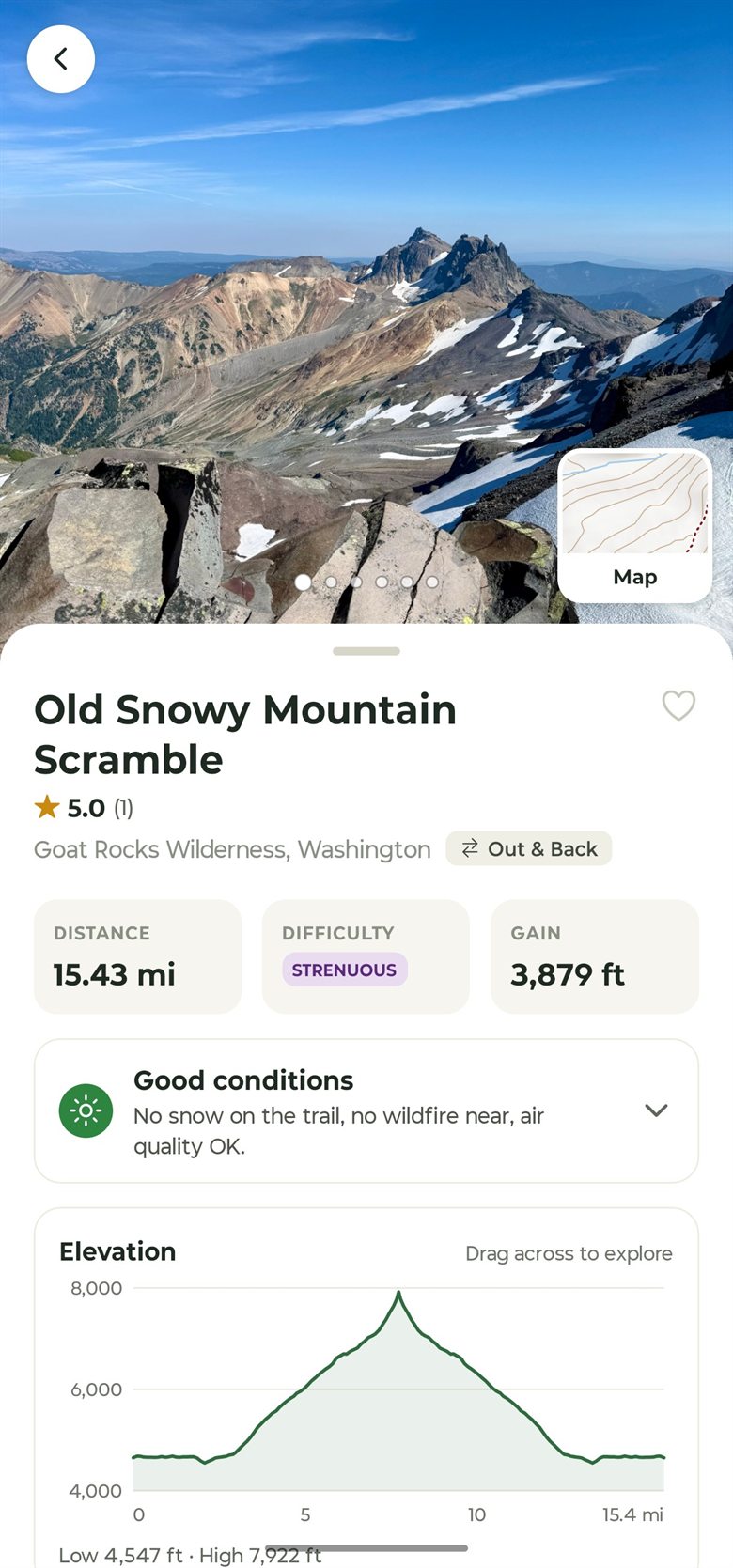
Get to know the trail
Trail length and gain, an elevation chart, and today’s snow, wildfire and air quality on one page.
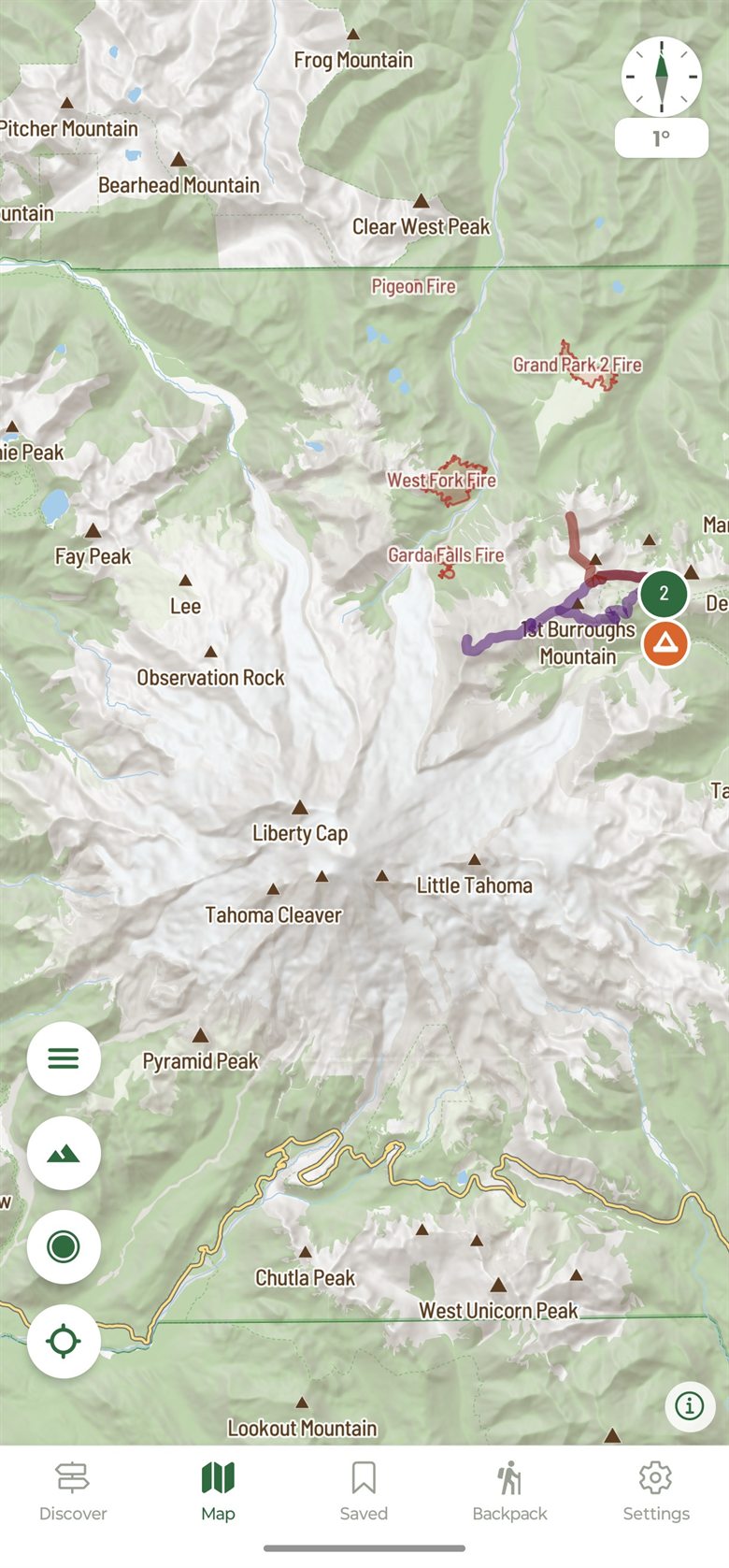
A map made for the mountains
Shaded terrain, contour lines and named peaks, with overlays such as active wildfires. Download an area and it all works with no signal.
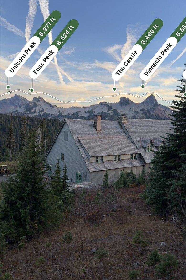
Name the skyline
Peak ID draws the horizon and labels the summits you can actually see from where you stand, even without signal.
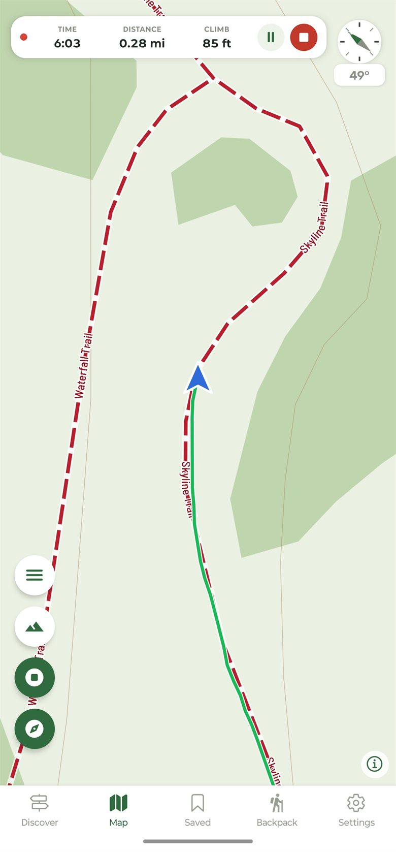
Record your day
Your line, time, distance and gain as you go, and a saved hike with its own elevation chart when you’re done.
Where it works
Built in the Northwest, growing from there.
Trails and campgrounds are in for the states below, and more are added regularly. The base map itself, recording and offline downloads work anywhere in North America.
Try it in your browser today.
Create a free account on the web app. Your saved trails, tracks and packing list will be waiting in the phone apps when they arrive.