Hayduke Trail
Utah, Arizona, Arizona
303.7 miLength
41,500 ftElevation gain
StrenuousDifficulty
Point to PointRoute
A one-way trail of 303.7 mi in Utah.
It goes up and down rather than rising steadily: about 41,070 ft of elevation gain along the way, between 2,440 ft and 9,170 ft.
The steepest stretch is between 165.5 mi and 166 mi from the trailhead, gaining 3,700 ft.
On the way it passes near Dog Lake, Deer Creek Falls, Thunder River Falls.
Described from the map and elevation data.
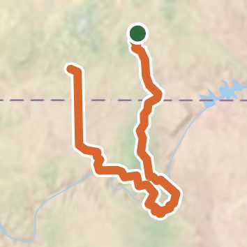
Open in Sahale GPS
See the trail on the map, download it for offline use and record your hike. The iPhone and Android apps are on their way.
Before you go: trail information can be out of date or wrong, and a trail may be closed or on private land. Check current conditions with the land manager. You hike at your own risk. Full notice
On this hike
- Summits on this hike: Checkerboard Mesa, The Tipoff
- Waterfalls on this hike: Deer Creek Falls, Thunder River Falls
- Rivers and creeks on this hike: Bright Angel Creek, Buckskin Gulch, Bullrush Gorge, Bullrush Hollow, Clear Creek, Colorado River, and 24 more
- Viewpoints on this hike: East Rim Viewpoint, Jolley Gulch, Coconino Overlook, Deer Creek Falls Viewpoint, Checkerboard Mesa, 2 unnamed viewpoints
Elevation profile
Low 2,440 ft303.7 miHigh 9,170 ft
Camping nearby
- East Fork Dispersed Site 12.6 mi from the trailhead
- East Fork Dispersed Site 2-32.9 mi from the trailhead
- East Fork Dispersed Site 43.1 mi from the trailhead
- King Creek Campground3.4 mi from the trailhead