Sky Islands Traverse
Coronado National Forest, Arizona
An out-and-back in Coronado National Forest, 830 mi round trip.
It goes up and down rather than rising steadily: about 73,940 ft of elevation gain on the way out, between 2,830 ft and 10,010 ft.
The steepest stretch is between 113.9 mi and 114.4 mi from the trailhead, gaining 610 ft.
On the way it passes near Miller Peak Wilderness, Mount Wrightson Wilderness, Santa Teresa Wilderness.
The trailhead is about 17.4 mi north-east of Tucson in a straight line.
There are 3 campgrounds within 2 mi of the trailhead; the nearest is Spencer Canyon Campground.
Described from the map and elevation data.
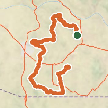
See the trail on the map, download it for offline use and record your hike. The iPhone and Android apps are on their way.
Before you go: trail information can be out of date or wrong, and a trail may be closed or on private land. Check current conditions with the land manager. You hike at your own risk. Full notice
On this hike
- Summits on this hike: Ladybug Peak, Webb Peak, Rattlesnake Mesa
- Lakes on this hike: Green Kingfisher Pond
- Rivers and creeks on this hike: Chimenea Canyon, Clifford Wash, Cottonwood Canyon, East Fork Sabino Creek, Fourmile Canyon, Harshaw Creek, and 17 more
- Viewpoints on this hike: San Pedro Vista, 3 unnamed viewpoints
Elevation profile
Nearby trails
- Arizona Trail Pusch Ridge Wilderness Bypass34.9 mi · Strenuous · same trailhead
- Aspen Trail #937.9 mi · Hard · same trailhead
- Mint Spring Trail #203.4 mi · Moderate · 1.0 mi away
- Box Camp Trail #2210.5 mi · Strenuous · 1.1 mi away
- Box Spring Trail #22A4.2 mi · Hard · 1.1 mi away
- Oracle Ridge Trail #13.6 mi · Moderate · 1.6 mi away
Camping nearby
- Spencer Canyon Campground1.2 mi from the trailhead
- Whitetail Campground1.8 mi from the trailhead
- Mt. Bigelow Dispersed Camping1.9 mi from the trailhead
- Showers Point Group Site2.5 mi from the trailhead