PCT - California Section H
Sequoia-Kings Canyon Wilderness, California
A one-way trail of 178.4 mi in Ansel Adams Wilderness, Kings Canyon National Park.
It goes up and down rather than rising steadily: about 34,330 ft of elevation gain along the way, between 7,440 ft and 13,140 ft.
The steepest stretch is between 153 mi and 153.5 mi from the trailhead, gaining 500 ft.
On the way it passes near Evolution Creek Falls, Sallie Keyes Lakes, Nüümü Hu Hupi.
The trailhead is about 6.6 mi west of Mammoth Lakes in a straight line.
There are 2 campgrounds within 2 mi of the trailhead; the nearest is Agnew Meadows Group Camp.
Described from the map and elevation data.
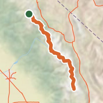
See the trail on the map, download it for offline use and record your hike. The iPhone and Android apps are on their way.
Before you go: trail information can be out of date or wrong, and a trail may be closed or on private land. Check current conditions with the land manager. You hike at your own risk. Full notice
On this hike
- Lakes on this hike: Heart Lake, Middle Rae Lake, Upper Rae Lake, Wanda Lake, Lower Palisade Lake, Sallie Keyes Lakes, and 13 more
- Waterfalls on this hike: Upper Evolution Creek Falls, Minarets Falls, 1 unnamed waterfall
- Rivers and creeks on this hike: Bear Creek, Bubbs Creek, Crater Creek, Dana Fork, Evolution Creek, Fish Creek, and 13 more
- Viewpoints on this hike: 4 unnamed viewpoints
Elevation profile
Nearby trails
- Shadow Creek Trail16.3 mi · Strenuous · same trailhead
- High Trail13.6 mi · Strenuous · same trailhead
- Laura Lake Trail12.7 mi · Strenuous · 0.2 mi away
- Ansel Adams Wilderness - River Trail14.4 mi · Strenuous · 0.2 mi away
- Ediza Lake Spur Trail14 mi · Strenuous · 0.2 mi away
- Garnet Lake Cutoff11.6 mi · Strenuous · 0.2 mi away
Camping nearby
- Agnew Horse Camp0.3 mi from the trailhead
- Agnew Meadows Group Camp0.3 mi from the trailhead
- Soda Springs Campground2.1 mi from the trailhead
- Pumice Flat Group Camp2.6 mi from the trailhead