CDT - Colorado Section
Colorado
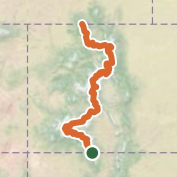
A one-way trail of 730.4 mi in Weminuche Wilderness, Arapaho National Forest.
It goes up and down rather than rising steadily: about 129,820 ft of elevation gain along the way, between 8,060 ft and 14,260 ft, ending near Muddy Pass Lake.
The steepest stretch is between 486 mi and 486.5 mi from the trailhead, gaining 560 ft.
On the way it passes near Cascade Falls, Granite Falls, Rock Lake.
Described from the map and elevation data.
See the trail on the map, download it for offline use and record your hike. The iPhone and Android apps are on their way.
Before you go: trail information can be out of date or wrong, and a trail may be closed or on private land. Check current conditions with the land manager. You hike at your own risk. Full notice
On this hike
- Summits on this hike: Geneva Peak, Parkview Mountain, Mount Flora, Mount Edwards, James Peak, Sullivan Mountain, and 5 more
- Lakes on this hike: Twin Lakes, Lake Granby, Blue Lake, Shadow Mountain Lake, Fishhook Lake, Monarch Lake, and 10 more
- Waterfalls on this hike: Cascade Falls, Granite Falls
- Rivers and creeks on this hike: Adams Fork Conejos River, Archuleta Creek, Cataract Creek, Clear Creek, Cochetopa Creek, Colorado River, and 23 more
- Viewpoints on this hike: Old Monarch Pass, CDT Chama Basin Overview, Lake Ann Pass, Searle Pass, Hope Pass, Parkview Pass, and 1 more, 1 unnamed viewpoint
Elevation profile
Nearby trails
- Chama Chile3.6 mi · Moderate · 1.2 mi away
- Chama River Trail9.4 mi · Hard · 6.0 mi away
- Archuleta Trail22.5 mi · Strenuous · 6.0 mi away
- Hughes Trail12.5 mi · Strenuous · 6.0 mi away
- Red Lake Trail5.1 mi · Moderate · 6.6 mi away
- Duck Lake Trail7.8 mi · Hard · 9.4 mi away
Camping nearby
- Dispersed camping2.5 mi from the trailhead
- Dispersed camping2.6 mi from the trailhead
- Trujillo Meadows Campground3.7 mi from the trailhead
- Chama Basin Trailhead Campground6.0 mi from the trailhead