Van Tuyl Trail 431
Fossil Ridge Recreation Management Area, Colorado
An out-and-back in Fossil Ridge Recreation Management Area, Gunnison National Forest, 15.6 mi round trip.
It gains 3,630 ft over 7.7 mi, from 8,430 ft at the trailhead to 11,030 ft.
The steepest stretch is between 6.1 mi and 6.6 mi from the trailhead, gaining 530 ft.
The trailhead is about 15.3 mi north-east of Gunnison in a straight line.
There are 3 campgrounds within 2 mi of the trailhead; the nearest is North Bank Campground.
Described from the map and elevation data.
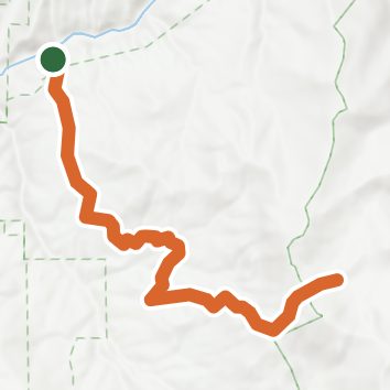
See the trail on the map, download it for offline use and record your hike. The iPhone and Android apps are on their way.
Before you go: trail information can be out of date or wrong, and a trail may be closed or on private land. Check current conditions with the land manager. You hike at your own risk. Full notice
On this hike
- Rivers and creeks on this hike: Onemile Creek
Elevation profile
Nearby trails
- Seely Trail 61716.6 mi · Strenuous · same trailhead
- Three Mile Creek Trail 4349.5 mi · Strenuous · same trailhead
- Five Mile Trail 6044.4 mi · Hard · same trailhead
- Van Tuyl22.7 mi · Strenuous · same trailhead
- Cougar Canyon Trail 6144.4 mi · Hard · same trailhead
- Doctor Park Trail12.9 mi · Strenuous · 0.3 mi away
Camping nearby
- One Mile0.1 mi from the trailhead
- North Bank Campground0.2 mi from the trailhead
- Granite Tent Campground0.4 mi from the trailhead
- Rosy Lane0.8 mi from the trailhead