Appalachian Trail
Appalachian National Scenic Trail, Maine
A one-way trail of 257.4 mi in Appalachian National Scenic Trail.
It goes up and down rather than rising steadily: about 62,510 ft of elevation gain along the way, between 480 ft and 5,260 ft, ending near Baxter Peak.
The steepest stretch is between 30.6 mi and 31.1 mi from the trailhead, gaining 870 ft.
On the way it passes near Katahdin Falls, Little Wilson Upper Falls, Vaughn Stream Falls.
The trailhead is about 8.2 mi east of Berlin in a straight line.
Described from the map and elevation data.
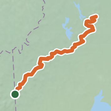
See the trail on the map, download it for offline use and record your hike. The iPhone and Android apps are on their way.
Before you go: trail information can be out of date or wrong, and a trail may be closed or on private land. Check current conditions with the land manager. You hike at your own risk. Full notice
On this hike
- Summits on this hike: Crocker Mountain, Little Bigelow Mountain, Old Blue Mountain, Carlo Col, South Peak, West Peak, and 25 more
- Lakes on this hike: Speck Pond, Crawford Pond, Crescent Pond, East Carry Pond, Lower Jo-Mary Lake, North Pond, and 29 more
- Waterfalls on this hike: Little Wilson Upper Falls, Katahdin Falls, Vaughn Stream Falls, Cooper Brook Falls, Slugundy Upper Falls, Big Niagara Falls, Little Niagara Falls, Slugundy Lower Falls, 4 unnamed waterfalls
- Rivers and creeks on this hike: Bald Mountain Stream, Big Wilson Stream, Chase Brook, Cooper Brook, Gulf Hagas Brook, Holly Brook, and 12 more
- Viewpoints on this hike: Rainbow Ledges, Barren Ledges, 7 unnamed viewpoints
Elevation profile
Nearby trails
- Notch Trail4 mi · Moderate · 3.6 mi away
- Mahoosuc Ecological Reserve - Summit Trail8.4 mi · Strenuous · 4.8 mi away
- Wright Trail7.7 mi · Strenuous · 4.8 mi away
- Speck Pond Trail6.2 mi · Hard · 5.2 mi away
- Jordan Loop2.1 mi · Moderate · 5.9 mi away
- Beechnut Loop1.2 mi · Easy · 6.0 mi away
Camping nearby
- Timberland Campground6.3 mi from the trailhead
- Trident Col Tentsite6.4 mi from the trailhead
- Hastings Campground9.4 mi from the trailhead
- Grafton Notch Campground9.8 mi from the trailhead