Katy Trail State Park
Katy Trail State Park, Missouri
478.6 miLength
4,050 ftElevation gain
StrenuousDifficulty
Out & BackRoute
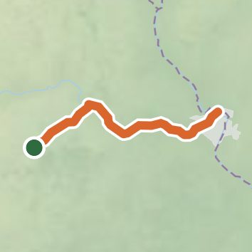
An out-and-back in Katy Trail State Park, 478.6 mi round trip.
It goes up and down rather than rising steadily: about 2,710 ft of elevation gain on the way out, between 510 ft and 950 ft.
The trailhead is in Boonville.
Described from the map and elevation data.
Open in Sahale GPS
See the trail on the map, download it for offline use and record your hike. The iPhone and Android apps are on their way.
Before you go: trail information can be out of date or wrong, and a trail may be closed or on private land. Check current conditions with the land manager. You hike at your own risk. Full notice
On this hike
- Summits on this hike: Katy trail highest point
- Lakes on this hike: Lake Alcolac, Hamburg Quarry
- Waterfalls on this hike: 1 unnamed waterfall
- Rivers and creeks on this hike: Bigelow Creek, Bonne Femme Creek, Hillers Creek, Lamine River, Logan Creek, Rupe Branch, and 2 more
- Viewpoints on this hike: 9 unnamed viewpoints
Elevation profile
Low 430 ft478.6 miHigh 950 ft
Nearby trails
- ADT - Missouri - L - Seg 3134.4 mi · Strenuous · 0.3 mi away
- Little Muddy Trail5.9 mi · Easy · 7.3 mi away
- Tallgrass Prairie Trail0.6 mi · Easy · 7.5 mi away
- Cottonwood Scour Trail0.4 mi · Easy · 8.6 mi away
- Levee Trail to Missouri River1.8 mi · Easy · 8.7 mi away
- Pierre a Fleche Trail3 mi · Easy · 12.4 mi away
Camping nearby
- Katy Roundhouse CG2.6 mi from the trailhead
- MRVSEA Campground8.8 mi from the trailhead
- Arrow Rock State Historic Site Campground12.0 mi from the trailhead