Gold Dollar Trail
Absaroka–Beartooth Wilderness, Montana
An out-and-back in Absaroka–Beartooth Wilderness, Custer Gallatin National Forest, 24.6 mi round trip.
It gains 1,130 ft in the first 11.3 mi to a high point at 9,570 ft, then drops 830 ft to Lake of the Woods; that drop is more elevation gain on the way back.
The steepest stretch is between 6.7 mi and 7.2 mi from the trailhead, gaining 420 ft.
On the way it passes near Lake Abundance.
Described from the map and elevation data.
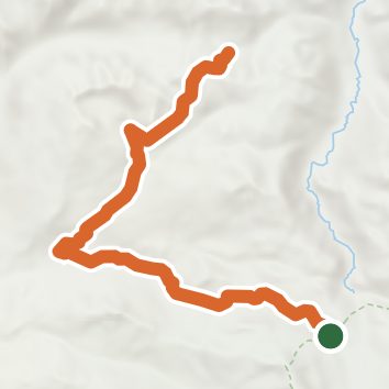
See the trail on the map, download it for offline use and record your hike. The iPhone and Android apps are on their way.
Before you go: trail information can be out of date or wrong, and a trail may be closed or on private land. Check current conditions with the land manager. You hike at your own risk. Full notice
On this hike
- Lakes on this hike: Lake Abundance
- Rivers and creeks on this hike: Lake Abundance Creek
Elevation profile
Nearby trails
- Horseshoe Mountain Trail24.4 mi · Strenuous · same trailhead
- Lake Creek Trail12.6 mi · Hard · same trailhead
- Lake Of The Woods Trail32.6 mi · Strenuous · 0.2 mi away
- Wolverine Pass Cutoff2.8 mi · Moderate · 1.3 mi away
- Lost Wolverine Trail22.8 mi · Strenuous · 2.7 mi away
- Grasshopper Glacier Trail5.3 mi · Hard · 4.6 mi away
Camping nearby
- Soda Butte Campground6.2 mi from the trailhead
- Colter Campground6.6 mi from the trailhead
- Fox Creek Campground11.2 mi from the trailhead
- Pebble Creek Campground12.8 mi from the trailhead