Cohos Trail
New Hampshire
An out-and-back in Nash Stream Forest, White Mountain National Forest, 294.2 mi round trip.
It goes up and down rather than rising steadily: about 29,360 ft of elevation gain on the way out, between 980 ft and 4,470 ft, ending near Presidential Range-Dry River Wilderness.
The steepest stretch is between 131.5 mi and 132 mi from the trailhead, gaining 690 ft.
On the way it passes near Huntington Cascades, Baby Flume, Falls.
Described from the map and elevation data.
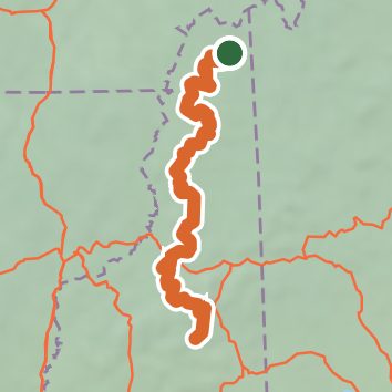
See the trail on the map, download it for offline use and record your hike. The iPhone and Android apps are on their way.
Before you go: trail information can be out of date or wrong, and a trail may be closed or on private land. Check current conditions with the land manager. You hike at your own risk. Full notice
On this hike
- Summits on this hike: Middle Weeks Mountain, Mount Weeks, South Weeks Mountain, Mount Cabot, Mount Martha, Rogers Ledge, and 9 more
- Lakes on this hike: Cherry Pond, South Pond, Kilback Pond, Second Connecticut Lake, Lake Francis, First Connecticut Lake, and 1 more
- Waterfalls on this hike: Huntington Cascades, Baby Flume, Middle Falls, Pond Brook Falls, Upper Falls
- Rivers and creeks on this hike: Abenaki Brook, Ammonoosuc River, Cascade Brook, Connecticut River, Deception Brook, Haines Brook, and 3 more
- Viewpoints on this hike: Bunnell Rock, Tudor Richards Viewing Platform, 6 unnamed viewpoints
Elevation profile
Nearby trails
- Moose Alley Trail0.3 mi · Easy · 1.5 mi away
- Tilton Path1.4 mi · Easy · 2.5 mi away
- Gordons Trail1.5 mi · Easy · 2.6 mi away
- Lynx Trail1.5 mi · Easy · 2.8 mi away
- Gordons Trail1.6 mi · Easy · 3.4 mi away
- Camp Otter Trail3.5 mi · Easy · 3.8 mi away
Camping nearby
- Deer Mountain Campground3.5 mi from the trailhead
- Ramblewood Campground5.6 mi from the trailhead
- Hidden Acres Cabins and Campground9.2 mi from the trailhead