Patriots' Path
New Jersey
58 miLength
4,570 ftElevation gain
StrenuousDifficulty
Point to PointRoute
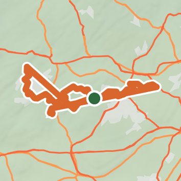
A one-way trail of 58 mi in New Jersey.
It goes up and down rather than rising steadily: about 4,530 ft of elevation gain along the way, between 160 ft and 1,100 ft.
The steepest stretch is between 55.5 mi and 56 mi from the trailhead, gaining 540 ft.
On the way it passes near Bee Meadow Pond.
The trailhead is about 3.9 mi south of Randolph in a straight line.
Described from the map and elevation data.
Open in Sahale GPS
See the trail on the map, download it for offline use and record your hike. The iPhone and Android apps are on their way.
Before you go: trail information can be out of date or wrong, and a trail may be closed or on private land. Check current conditions with the land manager. You hike at your own risk. Full notice
On this hike
- Summits on this hike: Seward Hill
- Lakes on this hike: Heistein Pond, Lake Pocahontas, Speedwell Lake, Clyde Potts Reservoir, Bee Meadow Pond
- Rivers and creeks on this hike: Dismal Brook, Electric Brook, Harmony Brook, India Brook, Lamington River, Malapardis Brook, and 5 more
- Viewpoints on this hike: Seward Hill, 1 unnamed viewpoint
Elevation profile
Low 160 ft58 miHigh 1,100 ft
Nearby trails
- Dismal Harmony Natural Area - Yellow Trail1.1 mi · Easy · 0.7 mi away
- Purple Singletrack1.3 mi · Easy · 0.8 mi away
- Lewis Morris County Park - Purple Trail0.9 mi · Easy · 0.8 mi away
- Dismal Harmony Natural Area - Pink Trail2.5 mi · Easy · 0.9 mi away
- Dismal Harmony Natural Area - Yellow Trail0.8 mi · Easy · 1.0 mi away
- Lewis Morris County Park - Yellow Trail4.4 mi · Moderate · 1.3 mi away
Camping nearby
- Sky Farm9.9 mi from the trailhead
- Panther Lake Camping Resort14.9 mi from the trailhead