CDT - New Mexico Section
New Mexico
A one-way trail of 797.2 mi in Carson National Forest, Gila National Forest.
It goes up and down rather than rising steadily: about 74,590 ft of elevation gain along the way, between 4,200 ft and 11,030 ft, ending near Cold Lake.
The steepest stretch is between 343.7 mi and 344.2 mi from the trailhead, gaining 370 ft.
On the way it passes near Laguna Tarrito, Tres Lagunas, Batton Pond.
Described from the map and elevation data.
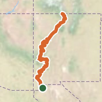
See the trail on the map, download it for offline use and record your hike. The iPhone and Android apps are on their way.
Before you go: trail information can be out of date or wrong, and a trail may be closed or on private land. Check current conditions with the land manager. You hike at your own risk. Full notice
On this hike
- Summits on this hike: Burro Peak
- Lakes on this hike: Seep Tank, Upper Canjilon Lakes, Hale Tank, Green Tank, New Coyote Tank
- Rivers and creeks on this hike: Caledonia Creek, Cañada Gurule, Cañada Jarosita, Canjilon Creek, Chloride Creek, East Fork Rio Brazos, and 9 more
- Viewpoints on this hike: Brazos Ridge Overlook
Elevation profile
Nearby trails
- Continental Divide National Scenic Trail2,999.1 mi · Strenuous · same trailhead
- CDT ja- New Mexico Alternates10.4 mi · Hard · 10.0 mi away