Uinta Highline Trail
High Uintas Wilderness, Utah
A one-way trail of 103.4 mi in High Uintas Wilderness, Ashley National Forest.
It goes up and down rather than rising steadily: about 18,530 ft of elevation gain along the way, between 8,190 ft and 12,700 ft, ending near Scudder Lake.
The steepest stretch is between 86.4 mi and 86.9 mi from the trailhead, gaining 510 ft.
On the way it passes near Lake Wilde, Tungsten Lake, Deadman Lake.
Red Springs Campground is within 2 mi of the trailhead.
Described from the map and elevation data.
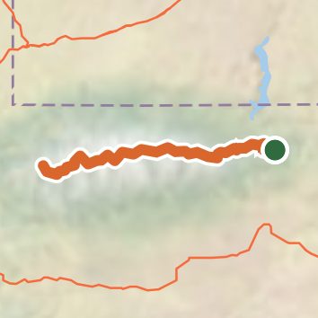
See the trail on the map, download it for offline use and record your hike. The iPhone and Android apps are on their way.
Before you go: trail information can be out of date or wrong, and a trail may be closed or on private land. Check current conditions with the land manager. You hike at your own risk. Full notice
On this hike
- Lakes on this hike: Y-19, Lake Wilde, Chepeta Lake, Whiterocks Lake, Fox Lake, Tungsten Lake, and 7 more
- Rivers and creeks on this hike: Little Brush
Elevation profile
Nearby trails
- Lake Park Trail10 mi · Hard · 4.1 mi away
- Round Park Trail4.2 mi · Easy · 4.6 mi away
- Beaver Pond Interpretive Trail0.4 mi · Easy · 4.7 mi away
- Oaks Park - East Park Trail4.5 mi · Moderate · 4.8 mi away
- Bassett Springs Spur B Trail8 mi · Hard · 5.3 mi away
- Round Park South Trail0.7 mi · Easy · 5.4 mi away
Camping nearby
- Red Springs Campground1.1 mi from the trailhead
- Lodgepole At Flaming Gorge1.5 mi from the trailhead
- Grizzly Ridge Meadow Camping Area2.9 mi from the trailhead
- Grizzly Ridge Yurt3.7 mi from the trailhead