Appalachian Trail
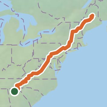
Georgia, North Carolina, Virginia, West Virginia, Maryland, Pennsylvania, New York, Connecticut, Massachusetts, Vermont, New Hampshire, Maine, Vermont
2,115.5 miLength
455,940 ftElevation gain
StrenuousDifficulty
Point to PointRoute
Open in Sahale GPS
See the trail on the map, download it for offline use and record your hike. The iPhone and Android apps are on their way.
Before you go: trail information can be out of date or wrong, and a trail may be closed or on private land. Check current conditions with the land manager. You hike at your own risk. Full notice
On this hike
- Summits on this hike: Blue Mountain, Monument Knob, North Lafayette, Rocky Top, Calf Mountain, Hump Mountain, and 216 more
- Lakes on this hike: Benedict Pond, Center Pond, Connecticut River Reservoir, Crawford Pond, Crescent Pond, Cushaw Reservoir, and 63 more
- Waterfalls on this hike: Vaughn Stream Falls, Comer’s Creek Falls, Sages Ravine Falls, Katahdin Falls, Little Wilson Upper Falls, Zealand Falls, Mountaineer Falls, Thundering Brook Falls, Dunnfield Creek Falls, Bear Rock Falls, Slugundy Upper Falls, Great Falls, Cooper Brook Falls, Long Creek Falls, Amicalola Falls, Laurel Falls, Big Niagara Falls, Splash Dam Falls, Little Niagara Falls, Pua Falls, Slugundy Lower Falls, Nantahala Falls, Jones Falls, 8 unnamed waterfalls
- Rivers and creeks on this hike: Bald Mountain Stream, Bear Hollow, Beaver Brook, Big Black Branch, Big Stony Creek, Big Wilson Stream, and 52 more
- Viewpoints on this hike: Little Stony Man Overlook, Webster cliffs, Cole, Eastman Ledge, Hawk Rock, Perkins Memorial Tower, and 61 more, 172 unnamed viewpoints
Elevation profile
Low -0 ft2,115.4 miHigh 6,600 ft
Camping nearby
- Amicalola Falls State Park Campground0.3 mi from the trailhead
- Under the Hemlock1.8 mi from the trailhead
- Amicalola Mountain2.2 mi from the trailhead
- Fausett Farms Horse Trails2.8 mi from the trailhead