Hidden Lake Lookout
Mount Baker-Snoqualmie National Forest, Washington
Hidden Lake Lookout is an unforgettable alpine adventure deep in Washington's North Cascades, offering a challenging climb and some of the most spectacular mountain scenery in the region. The journey begins beneath a canopy of dense evergreen forest before gradually opening into the rugged Sibley Creek drainage. As the trail climbs higher, the landscape transforms into open alpine meadows, rocky slopes, and dramatic mountain terrain. A series of steep switchbacks leads toward the upper basin, where expansive views of the surrounding peaks begin to unfold.
Beyond the alpine basin, the route continues across increasingly rocky terrain toward a high mountain saddle, revealing the striking blue waters of Hidden Lake nestled far below. The final approach to the summit follows a rugged path across steep slopes and boulder-strewn terrain before reaching the historic Hidden Lake Lookout. Built in 1931, this former fire lookout remains perched high above the wilderness, offering an incredible vantage point over the surrounding mountain ranges.
From the summit, hikers are rewarded with sweeping views of some of the North Cascades' most recognizable peaks, including Forbidden Peak, Sahale Mountain, Boston Peak, Eldorado Peak, and Mount Baker. The combination of dramatic granite summits, glaciers, rugged ridgelines, and the secluded lake below makes this destination truly memorable.
This is a demanding hike best suited for experienced hikers who are comfortable with significant elevation gain, steep terrain, route-finding, and exposed scrambling. Lingering snow can create additional challenges early in the season, and an ice axe and appropriate snow-travel experience may be necessary. Proper preparation, changing mountain conditions, and careful attention to the route are essential.
The journey also requires planning before reaching the trailhead. The access road is rough and has experienced significant washout damage, so check current Forest Service road conditions before traveling. A high-clearance 4WD or AWD vehicle is generally recommended, although current road closures may prevent driving all the way to the trailhead.
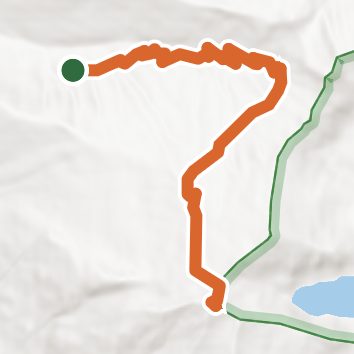
See the trail on the map, download it for offline use and record your hike. The iPhone and Android apps are on their way.
Before you go: trail information can be out of date or wrong, and a trail may be closed or on private land. Check current conditions with the land manager. You hike at your own risk. Full notice
On this hike
- Rivers and creeks on this hike: East Fork Sibley Creek
Elevation profile
Nearby trails
- Found Lake Trail9.5 mi · Strenuous · 3.3 mi away
- Snowking Mountain Trail12 mi · Strenuous · 3.4 mi away
- Monogram Lake Trail9.3 mi · Strenuous · 3.7 mi away
- Lookout Mountain Trail9 mi · Strenuous · 3.7 mi away
- South Fork Cascade River Trail19.3 mi · Strenuous · 4.5 mi away
- Middle Fork Cascade River Trail8.7 mi · Hard · 4.6 mi away
Camping nearby
- Marble Creek Campground2.6 mi from the trailhead
- Mineral Park Campground4.3 mi from the trailhead
- Cascade Wagon Road Campground9.0 mi from the trailhead
- Junction Hiker Camp10.4 mi from the trailhead