Lake Ivanhoe Trail
Alpine Lakes Wilderness, Washington
An out-and-back in Alpine Lakes Wilderness, Mount Baker-Snoqualmie National Forest, 26.9 mi round trip.
It gains 4,350 ft in the first 9.4 mi to a high point at 5,970 ft, then drops 1,330 ft to Lake Ivanhoe; that drop is more elevation gain on the way back.
The steepest stretch is between 8.7 mi and 9.2 mi from the trailhead, gaining 900 ft.
On the way it passes near Jade Lake, Chain Lakes, Necklace Valley Lakes.
Described from the map and elevation data.
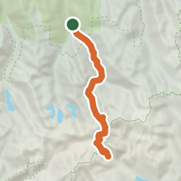
See the trail on the map, download it for offline use and record your hike. The iPhone and Android apps are on their way.
Before you go: trail information can be out of date or wrong, and a trail may be closed or on private land. Check current conditions with the land manager. You hike at your own risk. Full notice
On this hike
- Lakes on this hike: Jade Lake, Williams Lake, Chain Lakes, Lake Ivanhoe, La Bohn Lakes, Emerald Lake, and 1 more
- Rivers and creeks on this hike: East Fork Foss River, Middle Fork Snoqualmie River
Elevation profile
Nearby trails
- Chain Lakes Trail21.7 mi · Strenuous · same trailhead
- Mount Hinman West Ridge Trail22.6 mi · Strenuous · same trailhead
- Williams Lake Trail23.6 mi · Strenuous · same trailhead
- Tank Lakes Bootpath17.5 mi · Strenuous · same trailhead
- Necklace Valley Trail19.6 mi · Strenuous · same trailhead
- Rock Lake Trail3.8 mi · Hard · 1.7 mi away
Camping nearby
- Skykomish Ballpark4.3 mi from the trailhead
- West Fork Campground4.9 mi from the trailhead
- Beckler River Campground5.1 mi from the trailhead
- Miller River Group Camp5.3 mi from the trailhead