PCT - Washington Section H
Gifford Pinchot National Forest, Washington
A one-way trail of 144.3 mi in Mount Adams Wilderness, Goat Rocks Wilderness.
It goes up and down rather than rising steadily: about 27,400 ft of elevation gain along the way, between 80 ft and 7,210 ft, ending near Lutz Lake.
The steepest stretch is between 8.9 mi and 9.4 mi from the trailhead, gaining 430 ft.
On the way it passes near Sheep Lake, Green Lake, Sheep Lakes.
The trailhead is about 19.6 mi north-west of Hood River in a straight line.
Crest Camp is within 2 mi of the trailhead.
Described from the map and elevation data.
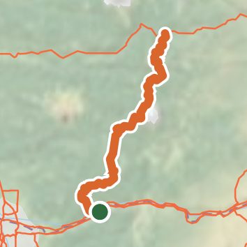
See the trail on the map, download it for offline use and record your hike. The iPhone and Android apps are on their way.
Before you go: trail information can be out of date or wrong, and a trail may be closed or on private land. Check current conditions with the land manager. You hike at your own risk. Full notice
On this hike
- Summits on this hike: Berry Mountain
- Lakes on this hike: Lake Bonneville, Blue Lake, Junction Lake, Greenleaf Pond, Ginnette Lake, Sheep Lake, and 5 more
- Rivers and creeks on this hike: Mutton Creek, Panther Creek, North Fork Snag Creek
- Viewpoints on this hike: 1 unnamed viewpoint
Elevation profile
Nearby trails
- Panther Creek Falls Trail #1370.5 mi · Easy · 3.1 mi away
- Falls Creek NWTA Trail 1526.6 mi · Hard · 3.8 mi away
- Falls Creek Lava Tubes Trail0.4 mi · Easy · 4.0 mi away
- Falls Creek Trail0.4 mi · Easy · 4.4 mi away
- Indian Race Track Trail #1713 mi · Moderate · 4.6 mi away
- McClellan Meadows Trail #1576 mi · Moderate · 4.7 mi away
Camping nearby
- Crest Camp0.0 mi from the trailhead
- Goose Lake Campground3.0 mi from the trailhead
- Forlorn Lakes Campground: Sites 1-33.7 mi from the trailhead
- Forlorn Lakes Campground: Sites 4-83.8 mi from the trailhead