Salmo Cabin Trail
Salmo Research Natural Area, Washington
9.7 miLength
2,590 ftElevation gain
StrenuousDifficulty
Out & BackRoute
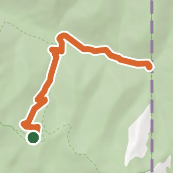
An out-and-back in Salmo Research Natural Area, Salmo-Priest Wilderness, 9.7 mi round trip.
It goes downhill first, dropping 1,460 ft to 4,470 ft, so the elevation gain is on the way back.
Described from the map and elevation data.
Open in Sahale GPS
See the trail on the map, download it for offline use and record your hike. The iPhone and Android apps are on their way.
Before you go: trail information can be out of date or wrong, and a trail may be closed or on private land. Check current conditions with the land manager. You hike at your own risk. Full notice
On this hike
- Rivers and creeks on this hike: South Salmo River
Elevation profile
Low 4,030 ft9.7 miHigh 5,930 ft
Nearby trails
- Salmo Basin Trail16.2 mi · Strenuous · same trailhead
- Salmo Divide Trail #5356 mi · Hard · same trailhead
- Crowell Ridge Trail #51514.8 mi · Strenuous · 3.7 mi away
- Jackson Mountain Trail15.3 mi · Strenuous · 3.8 mi away
- Helmer Creek Trail15.4 mi · Strenuous · 3.8 mi away
- South Jackson Mountain Trail15.7 mi · Strenuous · 3.8 mi away
Camping nearby
- Gypsy Meadows Campsite3.7 mi from the trailhead
- Sullivan Creek Campground 183.8 mi from the trailhead
- Sullivan Creek Campground 174.6 mi from the trailhead
- 1013-0025.6 mi from the trailhead