Ice Lakes Trail
Popo Agie Wilderness, Wyoming
An out-and-back in Popo Agie Wilderness, Bridger Wilderness, 30 mi round trip.
It goes up and down rather than rising steadily: about 3,570 ft of elevation gain on the way out, between 8,830 ft and 11,000 ft, ending near Echo Lakes.
The steepest stretch is between 10 mi and 10.5 mi from the trailhead, gaining 490 ft.
On the way it passes near Baer Lakes, West Echo Lake, East Echo Lake.
Sweetwater Guard Station Campground is within 2 mi of the trailhead.
Described from the map and elevation data.
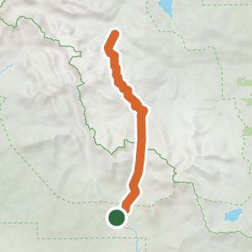
See the trail on the map, download it for offline use and record your hike. The iPhone and Android apps are on their way.
Before you go: trail information can be out of date or wrong, and a trail may be closed or on private land. Check current conditions with the land manager. You hike at your own risk. Full notice
On this hike
- Lakes on this hike: East Echo Lake, Cache Lake, West Echo Lake, Lower Baer Lake, Boot Lake, Lower Deep Creek Lake, and 2 more
- Rivers and creeks on this hike: Middle Popo Agie River, Sweetwater River
Elevation profile
Nearby trails
- Little Sandy Trail15.7 mi · Strenuous · same trailhead
- Sweetwater Gap Trail12.2 mi · Strenuous · same trailhead
- Coon Lake Trail23.7 mi · Strenuous · same trailhead
- CDT hfqCT Cirque of the Towers Route30.8 mi · Strenuous · same trailhead
- Tayo Lake Trail24 mi · Strenuous · same trailhead
- CDT -a-XX Continental Divide Trail Misc Alernate Old Routes37.1 mi · Strenuous · same trailhead
Camping nearby
- Sweetwater Guard Station Campground2.0 mi from the trailhead
- Blucher Creek Campground3.1 mi from the trailhead
- Sweetwater Bridge Campground4.8 mi from the trailhead
- Dutch Joe Campground9.2 mi from the trailhead